RaDa Intelligence · built in KenyaTRL 6 · operational · April 2026
The land knows.
RaDa just helps you
hear it sooner.
A Kenyan-built layer that joins what your soil already tells you, what the satellite sees from above, and what decades of climate memory hold — and hands the whole thing back to you, in your register of Swahili, before the climate event arrives. Built from mosopNandi · the highlands. Free for the community.
99Instrumented farmsContinuous telemetry across ten counties — the Rift, Mount Kenya, Ukambani and the Coast
48,000+Monitored 10-metre pixelsEvery pixel anchored to a real plot — the ground truth
1,000,000+Pixel-time observationsUnder continuous learning · twice-weekly auto-refresh
24moDigital twin depthPer farm, at activation — 24 months of memory
5Years of R&D before raiseThe Rada App — live in beta
§ 01 · The thesis
Yours, just
joined together.
The knowledge already lives on your shamba. In the soil. In the way the maize moves when the wind shifts. In what your grandmother told you about the rains. None of that is ours — it is yours, and it always was.
RaDa doesn't replace any of it. We join it to what the satellite saw last week, to decades of climate memory, and to what your neighbour's farm walk picked up this morning — and we hand the whole thing back to you, in your register of Swahili, before the climate event arrives. The app is ours. The data is ours. The community is ours. And it is open to everyone.
No subscription. No surveyor. No SMS spam. The Rada App is free for the community and stays that way — calibrated farm by farm, operated under Kenyan law, designed for the way connectivity actually works where you live.
Polygon descent · scroll to dive
From the basemap to the polygon — dissected into acres, points, spots.
Every registered shamba is a polygon on the satellite basemap. RaDa dissects it — acre by acre, sampling point by point — down to the individual 10-meter spot where stress begins. This is Arap Samoei Farm 05, west of Eldoret, exactly as the system read it on its July 7 pass. Scroll to descend.
Begin descent
0.5841°N 35.0814°ETarget · locked
SCALENational
IMAGERYGoogle satellite basemap
KUZA PASSJul 7 2026
§ continued · the intelligence stack
One polygon, 6 acres, fifty-nine points — and the one spot that needed attention today.
§ 07 · Why home-grown matters
Built in Kenya. By a Kenyan.
Calibrated by African farmers, owned by the community.
Africa is the most climate-vulnerable continent and home to most of the world's growing smallholder farming population. The agricultural intelligence layer that closes the gap between climate science and the smallholder's plot is not a luxury — it is the prerequisite for SDG 2, SDG 13, and Agenda 2063.
No external actor will build this layer for African farmers at the resolution they need. It has to be built by Africans, calibrated by African farmers, deployed first across African geographies, and operated under African legal jurisdictions — and it has to be theirs to keep. That is what RaDa Intelligence is — by structure, not by branding.
01 · Place
From mosop — the Nandi highlands, and the Mount Kenya belt.
RADA SAT SVC LTD incorporated in Eldoret in 2023. Validation farm operating in Uasin Gishu since 2021, with a second region now live across the Mount Kenya (Murima) horticulture belt. The founder's family roots reach into the same county the system is calibrated against. Read more →
02 · Connectivity
Designed for African reality.
The Rada App works offline on 2G and 3G handsets. Four Swahili registers because people pick the one that matches how they actually talk. Western precision-ag assumes neither.
03 · Jurisdiction
Operated under Kenyan law.
Cloud-native by architectural decision, with data resident in the EU region. Kenya Data Protection Act 2019, built to align with EU data law.
§ 02 · What we added on top
What we added on top of
what was already here.
None of the layers below are ours. We just put them in conversation with each other — and with your farm walk.
Many eyes on the same plot. We combine a mix of spectral bands and resolutions — from sub-metre down to the coarse continental record — so the fine detail and the long memory inform each other. Every signal is anchored to your 10-metre pixel and to the walk you took across it.
Multi-sensor fusion0.3–50 m resolutionsAnchored to the 10 m pixelDecades of climate memory
24 months of memory per farm. Twice-weekly autonomous refresh. Trained on 1,000,000+ pixel-time observations and 48,000+ monitored pixels, the model surfaces compounding stress days before it is visible to the eye¹. It gets sharper with every farm walk a member of the community logs — your knowledge is the teacher.
Continuous learningBiweekly refresh24-month memoryTrained by your walk
In your words, on your phone. The Rada App speaks to you in four registers of Swahili and works offline. Every observation sharpens the guidance that lands back on your phone the next time the satellite passes. The app is free; the data is yours; nothing is sold or brokered.
Rada App · AndroidFour Swahili registersFree for the communityNo data resale
¹ Hatfield et al., Agronomy Journal 2008 · Zhang & Kovacs, Precision Agriculture 2012.
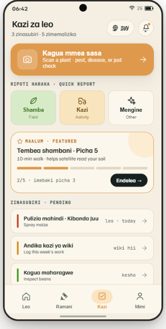
§ 03 · The Rada App · live in beta
Swahili-first. Offline-capable.
Free for the community.
Western precision-ag apps assume always-on connectivity and 100-hectare farms. We assume neither. The Rada App runs on 2G and 3G handsets, works offline, and speaks four Swahili registers — Standard, Mwananchi (Deep Kenyan), Komrad-Sheng, and Rasmi (Official) — because you pick the register that matches how you actually talk.
Every farm walk you log, every photo you take, every disease check you confirm becomes a labelled training point. The app is the calibration engine — and it is open to everyone, not just farmers.
§ 04 · Precision delta
If you can't see the row,
you can't manage the resource.
Standard EO · Insufficient
10m field-level colour
The standard product. The whole field looks fine. The two rows where pests broke through are invisible at this resolution.
RaDa Fusion · Row-level
30cm synthetic resolution
The same field, resolved to the row. Two stressed rows surface — and surface five days before the loss is visible from the ground.
Synthetic resolution
Sub-30cm
Row-level precision
Satellite refresh
5d
Government-grade cadence
Telemetry history
24mo
Continuous · full season
Lead time on stress
5d+
Before visible damage¹
§ 05 · The company behind it
A Kenyan software company.
The farms are the laboratory.
RaDa Intelligence is proprietary software — a geospatial-AI platform built and operated by RADA SAT SVC LTD in Kenya. The controlled farms we run are calibration and R&D infrastructure: the ground-truth generator that trains and validates the model. They are the laboratory, not the business. The business is the software.
The Rada App is free for the community — that never changes. What institutions pay for is the verified layer on top: governments, aggregators, exporters, insurers, banks and EU-compliance (EUDR) buyers subscribe to aggregate, farm-verified field intelligence. Aggregate only — your personal data is never sold or brokered. How pricing works →
Architecture · built end-to-end on Google Cloud
Satellite pipeline
Earth Engine
Sentinel-1/2 ingestion at 10 m
Data warehouse
BigQuery
Geospatial telemetry · EU region
Model training
Vertex AI
Training and inference
Serving layer
Cloud Functions
Ingestion and serving APIs
Founder
George Too
Born in Uasin Gishu County. Built RaDa from the validation farm up — the satellite-to-decision pipeline, the Rada App, and the company that carries them.
Chief Operating Officer
Eliza Chepkorir
Runs the operation on the ground — the field network and the farmer onboarding the calibration depends on. eliza@radaintelligence.com
Entity
RADA SAT SVC LTD
Incorporated in Eldoret, Kenya, 2023. Operated under the Kenya Data Protection Act 2019, with data resident in the EU region.
For the ones who fund the early signal
If you back things at the build phase — before the dashboards, before the take-rate, when the question is still whether a layer like this can truly belong to the people whose fields feed it — you are who this paragraph is for. RaDa is early, owned in Kenya, calibrated by Kenyans, with the satellite science contributed from above. It is built to stay the community's, and to reach beyond the highlands it started in. If that is the kind of bet you make, the door is open.